Thomas Jefferson bought a 215-foot limestone arch from Lord Fairfax in 1774 and called it one of the most sublime works of nature. The Monacan walked under it for centuries before he held the deed. This loop pairs that arch with the river the railroad followed: a paddled section of the 45-mile Roanoke Blueway, then Carvins Cove — 12,000 acres and a 630-acre reservoir that supplies the city's tap water and doubles as its backyard wilderness. The arch is the headline. The water is why anyone stayed.
The route
 1Nature & Parks·ancient·NRHPNatural Bridge
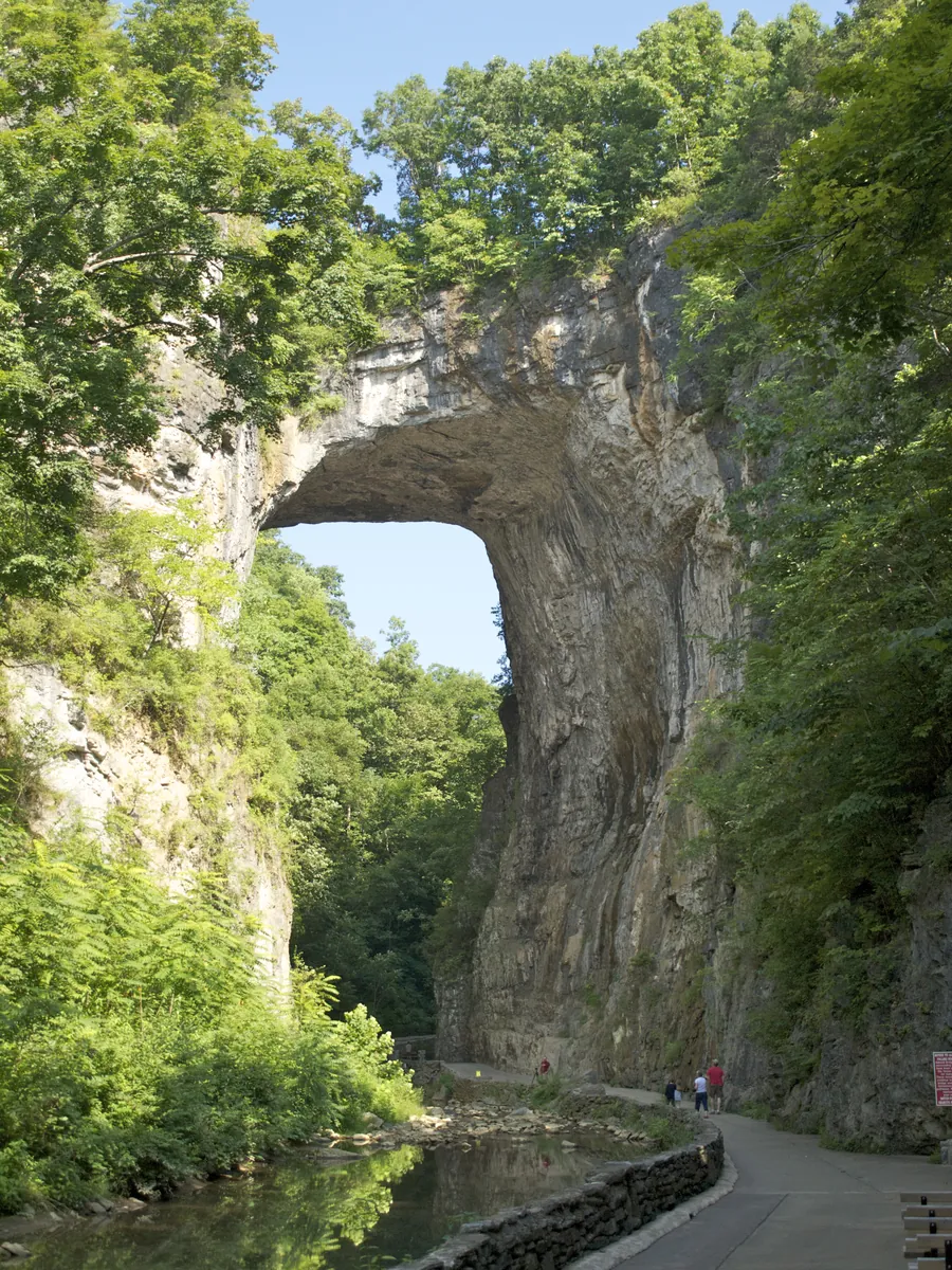
George Washington carved his initials into the rock face as a young surveyor — they're still there, cut into limestone 215 feet overhead. The arch is one of the tallest in the world, a span the Monacan people held sacred for centuries before any European saw it. Thomas Jefferson bought it from King George III, which means a founder of the republic once owned a geological formation older than the species. Roanoke sits fifty miles south, a city the railroad made by choosing it. The Natural Bridge is fifty minutes north, a place the earth made by patient chemical subtraction. Both facts matter — the valley's story is about what was chosen and what was already here. The Tutelo were driven out. The Scotch-Irish and Germans arrived. The rails came through in 1852, and thirty years later Big Lick became a city because Norfolk and Western said so. The Bridge remained, because stone doesn't negotiate. It's a Virginia State Park now. You pay admission, walk the waterfall trail below the arch, tour the caverns. The limestone is still doing what it's done since the Monacan — holding up the sky while a creek runs underneath. Washington's initials are high enough you'll need to look for them. Jefferson's purchase from the Crown is the kind of detail that makes you realize how recently this continent changed hands, and how old the continent is compared to the paperwork. Go because the arch is there, and because it was sacred before it was property, and because both those facts are still legible if you stand under it long enough.
 2Museum·1950Class J 611 Steam Locomotive — The Most Famous Engine in the South
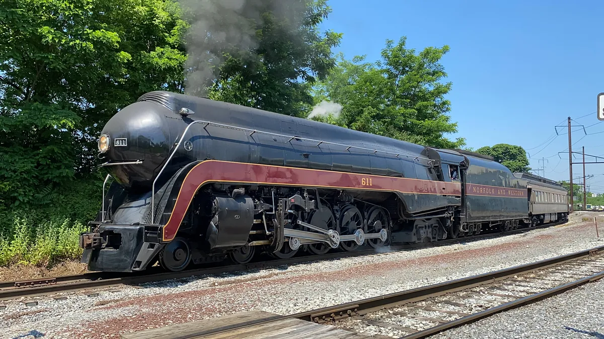
Roanoke didn't become the city it is by accident. In 1882, the Norfolk and Western Railway chose a small farming town called Big Lick as the site of its corporate headquarters and railroad shops. Within two years, that town had become the City of Roanoke. The railroad made everything here — and in May 1950, in those same East End Shops, it made the Class J No. 611. It came out of the shops as one of the last mainline passenger steam locomotives built in the United States, at a cost of $251,544. On flat terrain it could haul a fifteen-car train — 1,025 tons — at 110 miles per hour. Seventy-inch driving wheels, 80,000 pounds of tractive effort, 300 psi of boiler pressure, Timken roller bearings on every axle. It ran the Powhatan Arrow, the Pocahontas, and the Cavalier between Norfolk and Cincinnati — 676 miles of route — and ferried Southern Railway trains through the Blue Ridge between Monroe and Bristol. In January 1956, it derailed near Cedar, West Virginia — the engineer killed, dozens injured. Most railroads scrapped steam locomotives after wrecks like that. N&W president Robert H. Smith ordered it extensively repaired and back in service the following month. That accident was the country's last major steam-powered revenue passenger train wreck. Revenue service ended in 1959. The locomotive was donated to the Roanoke City Council and, in 1963, put on static display. In 1982 it ran again — on August 22, it arrived in Roanoke for the city's centennial, and Robert Claytor called it "Roanoke born, Roanoke bred, and Roanoke proud." It pulled mainline excursions until 1994, then came home again. In 2017, the Virginia General Assembly named it the official state steam locomotive. The 611 lives at the Virginia Museum of Transportation. It still runs excursion trips. When it fires up, the ground shakes. Check the VMT's schedule — tickets sell out months in advance.
 3Nature & Parks·1947Carvins Cove Natural Reserve
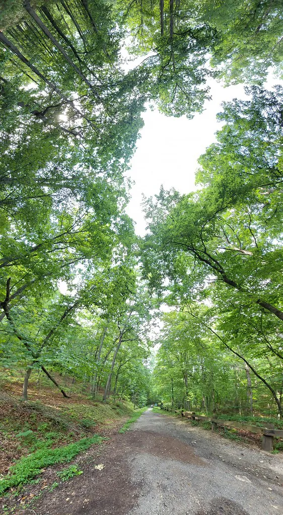
In the 1930s, the City of Roanoke dammed Carvins Creek and drowned a rural community to secure its drinking water. The reservoir that swallowed the hamlet of Carvins Cove now anchors 12,700 acres of municipal forest—the fifth-largest city park in the United States and the second-largest managed by a municipality. During droughts, the old roads and housing foundations reappear. Roanoke spent the 20th century annexing its way out of the county, and the water system followed the same logic: consolidation. After droughts in the late 1990s, the city and Roanoke County created the Western Virginia Water Authority, which now owns the 630-acre reservoir and everything below the 1,200-foot contour. The city owns the ridgeline above. In 2008, Roanoke placed 6,185 acres under a conservation easement—the largest ever recorded in Virginia—donated to the Western Virginia Land Trust and the Virginia Outdoors Foundation. Development stopped at the waterline. What that leaves is 60-plus miles of trail and a backyard trail system mountain bikers treat like public infrastructure. The XXC endurance race covers 43 miles and climbs over 6,000 feet. Some downhill runs are expert-level only and drop more than 1,000 feet from ridge to reservoir. Hikers can disappear for an entire day without crossing a road. The main ridgeline of Brushy Mountain rises about 1,200 feet above the waterline. The boat launch opens in April. Electric motors only—the fear of zebra mussels drove the city to restrict access in the early 1990s. Entry is free. Multiple trailheads off Carvins Cove Road.