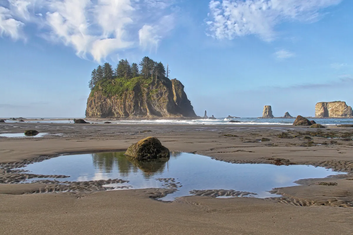
The Olympic Peninsula occupies the far northwestern corner of the contiguous United States with the deliberate completeness of a fortress. The Pacific Ocean holds its western flank. The Strait of Juan de Fuca seals the north. Hood Canal cuts it off from the east. What lies inside — roughly 3,600 square miles of terrain — resisted systematic documentation so thoroughly that Arthur Dodwell and Theodore Rixon didn't finish mapping its topography and timber resources until 1900. That is not a long time ago. The mountains at the center of the peninsula are the reason: they intercept moisture from the Pacific with such efficiency that the western valleys receive enough rainfall to produce temperate rainforest — the Hoh, the Queets, the Quinault — while the northeastern corner sits in their rain shadow, drier and quieter, as if it belongs to a different latitude entirely.
People have understood this geography for at least 13,500 years. Eight tribes — the Makah, Quileute, Hoh, Quinault, Skokomish, Port Gamble S'Klallam, Jamestown S'Klallam, and Lower Elwha Klallam — built their lives around the rivers and coasts here, reading what the land offered: salmon in the rivers, maritime resources in the bays, forest for everything else. The Spanish arrived in 1791, when explorer Francisco de Eliza entered the harbor at what would become Port Angeles and mapped it as Puerto de Nuestra Señora de los Ángeles. The name stayed, worn down to two words by time. The Klallam people who valued that same bay for its maritime resources had been there considerably longer.
American settlement came through the mechanism the federal government understood best: strategic designation. In 1862, President Abraham Lincoln signed a decree making the Port Angeles harbor a federal reserve for lighthouse construction and military purposes — an act that shaped the city's layout the way Washington D.C.'s was shaped, deliberately, from outside. A deep-water natural harbor protected by the long sand spit of Ediz Hook made the logic plain. Logging followed, and then fishing, and then a pulp and paper mill in 1920 that turned the city into the peninsula's industrial anchor. The railroad reached in 1914. The outside world had found its way in.
What changed the peninsula's relationship to itself was a different kind of federal attention. In 1897, President Grover Cleveland designated the area an Olympic Forest Reserve, responding to alarm about disappearing forests. In 1909, President Theodore Roosevelt protected a portion as Mount Olympus National Monument — specifically to defend the habitat of Roosevelt Elk, whose population was collapsing. By the 1880s, naturalist John Muir, Washington Congressman James Wickersham, and Lieutenant Joseph O'Neil, who led the first well-documented exploration of the peninsula's interior, had each separately argued for a national park here. In 1937, President Franklin Roosevelt visited Port Angeles and added his support. The following year, he signed the act establishing Olympic National Park, with Port Angeles as its headquarters.
What those overlapping designations produced is a peninsula where the wild interior was preserved before the logging economy could finish its work on it. The rivers still carry salmon — the Elwha, the Dungeness, the Quillayute, the Sol Duc, the Quinault, among others. Lake Crescent and Lake Ozette remain. In 2011, the historic project to remove the dams on the Elwha River began, restoring an ecosystem that industry had interrupted. The UNESCO International Biosphere Reserve designation came in 1976. World Heritage status followed in 1981. These are not honorary titles. They reflect what is actually here: temperate rainforest, alpine ridgeline, wild Pacific coastline, and the salmon-bearing rivers that eight tribes built their civilizations around — most of it intact because the arguments for preservation started early and, improbably, won.